
Tractors suddenly appeared at the entrance to Chispa Road near the US-Mexico border in rural Big Bend, Texas, in late March. Contractors informed Yolanda Alvarado, a cattle rancher, that they were starting work to upgrade the rough county dirt road there into a “highway” – the first step needed for semi trucks to haul the 30-foot steel pillars used to build Donald Trump’s border barrier.
“That fence line, that’s where the wall is going to be,” said Alvarado, hopping out of the front seat of her flatbed truck at the gate to the family property located directly along the path of the proposed wall.
The ranch house, a rough hour-long drive along the road, sits atop a bluff overlooking the Rio Grande floodplain with the rugged hills of Chihuahua in Mexico stretching out to the south.
“Over there by those pens, that’s where my grandparents are buried,” said Alvarado, whose family has been ranching in west Texas for five generations. “The wall will cut us in half.”
For her, the tractors were the first concrete evidence of what she and other residents had feared since it was announced in February that new parts of the border wall would be built in Big Bend. This rugged part of west Texas, long spared a constructed barrier due to its remoteness, rugged cliffs in parts and low rates of migrant crossings, has come into Trump’s crosshairs. The US president wants to fast-track construction throughout the border region.
“We never thought anyone would be so stupid to build a wall out here,” said Alvarado, whose family received a letter from the US Customs and Border Protection (CBP) agency in February notifying them that their property had been identified as a site for border wall construction. “It’s not just about our property, it’s about the wildlife, it’s walling off the river. It’s going to disrupt this whole ecosystem,” she said.
In February, CBP updated its interactive Smart Wall Map that depicted the status of barrier plans to indicate a “primary border wall system” within Big Bend nationalpark and nearby Big Bend ranch state park – two of the state’s largest and most cherished public lands. The proposed wall would sever wildlife migration routes, cut off public access to the Rio Grande and damage the region’s fragile ecosystem and tourism economy, as has happened to varying degrees in other parts along the border.
“Tourism drives everything here. There is no other economy,” said Linda Walker, owner of Big Bend and Lajitas Stables, which offers guided horseback rides in the state park. In March, the Big Bend Sentinel newspaper reported that Fisher Sand and Gravel was awarded a $1.2bn contract to build 70 to 80 miles of border wall from Ruidosa, a tiny, unincorporated community in Presidio county about 25o miles south-east of El Paso, to the top of Colorado Canyon, the first major canyon in the state park, and to run directly through their ranch. For Walker, both her property and company are at risk. “It would mean the end of my business,” said Walker. “We would never recover from a wall down here.”
Fisher Sand and Gravel is a contractor favored by Trump in border wall matters. The company has a history of environmental violations and being embroiled in litigation and political scandals tied to private border wall construction efforts in the first Trump administration.
The Big Bend region is named for the huge U‑shaped curve the Rio Grande takes along the Texas-Mexico border, swinging first south-east then north-east.
The local counties have a mix of political shades while leaning broadly Republican. But there has been an unprecedented bipartisan effort to oppose the wall. Conservative judges and sheriffs, environmentalists and grassroots organizers, local business owners and ranchers alike have united to oppose what they see as excessive federal government overreach and an action they believe can devastate the lands and livelihoods of residents.
“We are tied to the land here in west Texas,” said Alvarado, who currently spends much of her time speaking at town hall meetings, educating fellow landowners and trying to inform the public about the border wall. “This is not going down easy.”
In early March, CBP quietly changed the border wall map through the national park from a physical barrier to “detection technology”. But no formal statement has been issued by CBP regarding its plans for the park.
While many have celebrated this change and read it as an unprecedented bowing to public pressure not to build a towering physical impediment, in fact construction activity is starting across the region.
Roads have been widened, survey stakes are in the ground, environmental laws have been waived in various places and landowners throughout the Big Bend region have received letters from CBP regarding construction or access related to the border wall.
“There is still a border wall in Big Bend,” said Alvarado. “Our lives are being upended.”
This sentiment of upheaval was shared by the half dozen landowners and other border residents interviewed by the Guardian in late March and early April. Despite their varied backgrounds and politics, each expressed anxiety, uncertainty and, at times, anger over the disruption to their land and lives caused by what was viewed as an unnecessary border wall.
“It’s been a lot emotionally, a lot of uncertainty, no one really knows what’s going to happen,” said Denisse Carrera, a resident in Presidio.
Much of the angst is driven by the federal government’s lack of transparency and communication, which has repeatedly shifted plans and messages about the Big Bend wall with little notice to residents.
“I feel like we are at the end of a bull whip, that part that just flies around and pops in one direction or another,” said Raymond Skiles, a retired ranger for Big Bend national park, speaking from the back yard of his home in Alpine, Texas, which is 25 miles east of the high desert art magnet town of Marfa.
He received a 12-page letter from CBP outlining detailed plans to construct a physical barrier across the family’s property in Langtry, Texas. Not long after, the map changed to show only detection technology on his property.
For Skiles, the discordant messages from the federal government and the changing, unofficial CBP map are a stark contrast to “a letter signed by a real person saying exactly what they’re going to do”, he said. “I have to admit, for Texas people, this kind of communication is just inexcusable.”
Meanwhile, Billy Miller, 42, a river guide, owns 20 acres just upriver of Big Bend ranch state park. Unlike Skiles, he has not yet received a letter, despite his property having been designated for a physical barrier on CBP’s map. “It’s that sense of fighting against something you can’t see,” said Miller. “It’s a horrible feeling to not know what’s happening in your back yard.”
Then, a few days ago, Miller noticed that CBP had once again updated its map of his property, this time designating it for surveillance technology. At the same time, the Army Corps of Engineers has begun seeking access to the land for survey work – a strong indication that border wall construction may follow. Also, a contract for a “vertical barrier“ and “border wall construction“ has already been awarded through his property, so he is now thoroughly confused and churned up.
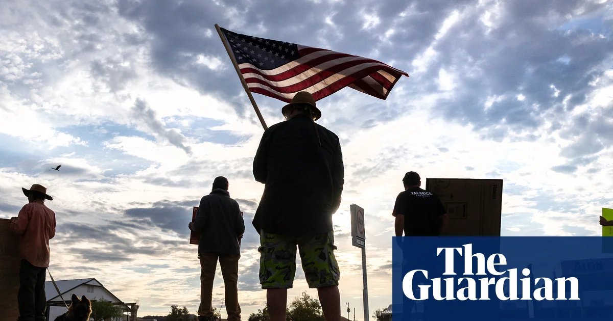
On 5 April, thousands of people rallied at the steps of the Texas capitol in Austin to protest wall plans.
Then on 6 April, the Center for Biological Diversity and the Texas Civil Rights Project sued CBP for withholding public records regarding planned border wall construction.
The lawsuit aims to reveal what is happening in the Big Bend sector, including in the state and national parks, where, regardless of the map, construction can start at any time without public notice, input or congressional approval.
“I have been really disheartened by some media reporting that this thing [border wall] is dead,” said Laiken Jordahl, national public lands advocate for the Center for Biological Diversity. “I don’t think they understand that when the government has bottomless pockets, and none of the regular laws apply, they can show up and start building tomorrow.”
Since Trump’s re-election, border wall expansion has accelerated sharply with a view to completing it, replacing the mostly piecemeal infill approach during the Biden administration with more ambitious plans to fulfil his promises since 2016 – when “build the wall” became a leading chant from his supporters in his first campaign and he erroneously claimed Mexico would “pay for it”.
The latest tranche of funding for the wall comes from the signature legislation passed so far in the second Trump administration, the One Big Beautiful Bill Act, which included $46bn to finish construction all the way from the California Pacific coast to the Texas gulf coast.
So far, the 517-mile Big Bend sector – nearly a quarter of the entire border – has been spared. Historically, Big Bend has recorded the fewest undocumented crossings along the border. Numbers have dipped even further as Trump’s aggressive immigration crackdown has led to historically low apprehension rates, from 1.5 million in 2024 to 237,565 in 2025, according to CBP data. Roughly 3,000 or a little more than 1% of apprehensions were in Big Bend.
“The numbers simply don’t justify this massive disruption to the ecosystem, the economy, the quality of life,” said Bob Krumenaker, former superintendent for Big Bend national park and spokesperson for the group Keep Big Bend Wild.
Existing surveillance technology, including AI-enabled towers, cameras, and aerial technology, is reinforced by the region’s harsh environment.
Nicole Martinez had travelled from Dallas to Big Bend for spring break. “The idea they would put a wall here is crazy,” Martinez said from the entrance to the iconic Hoodoos trail in Big Bend ranch state park, named after the eroded mushroom-shaped rock columns located along this section of the Rio Grande. “Where would they even build it?” said Martinez, noting that much of the Rio Grande in Big Bend winds through deep canyons, some with sheer cliffs rising up to 1,500ft.
Access to the border is difficult. Sean McGuire owns property near the national park, accessible only by a 27-mile dirt road that takes nearly three hours to reach.
“The idea that this is an emergency because there are so many crossings is a joke,” said McGuire, an environmental activist who spoke from his home near Terlingua, surrounded by red-blooming ocotillo cacti that proliferate throughout the Chihuahuan Desert.
McGuire spends much of his time hiking and canoeing on the border. “In 22 years, I’ve seen just one group of migrants,” he said.
In more than two decades guiding river trips in Big Bend, Miller has rarely seen people crossing – and for obvious reasons.
“I would say to anyone, contractor or otherwise, who wants hundreds of millions of dollars to build the wall, to start at the river and try and go anywhere on foot,” said Miller from his 20-acre property beside the Rio Grande, surrounded by salt cedar, mesquite and blooming paloverde. By mid-afternoon, as temperatures rose into the mid-90s fahrenheit, Miller and his dog Koozie retreated into the shade of a mesquite tree. “Is the wall a deterrent compared to the desert, the mountains, this heat?”
Catherine Eaves, Alpine’s mayor, said small towns in the region were ill-equipped to deal with an influx of hundreds, possibly thousands of workers that would be needed to erect the barrier. “It would be a similar situation to picking any remote spot in the Chihuahuan Desert and starting a brand new city,” said Eaves, noting the potential impact on limited groundwater, housing, and medical services.
The border wall is estimated to cost $17m a mile to build. This is commonly viewed as a staggering investment to those living in border communities, who are among the nation’s poorest and frequently lack essential resources and services.
“This is a scale of federal investment that the Big Bend region has never seen in its entire history,” said Jordahl.
“It’s disgusting,” said Alvarado. “A small percentage of the cost of that wall would be huge for the community.”
In early April, the Big Bend Sentinel reported that both Valentine and the city of Presidio have been approached by companies interested in utility hook-ups for large “man camps”. An RV park owner in Terlingua was asked to rent his park for approximately 500 people – nearly three times the population of the town.
This influx of hundreds of foreign men is a cause for concern. “We were safe here,” said Alvarado. “This [plan] makes us feel unsafe.”
Trump’s rhetoric about border migration as an “invasion”, “attack” and a national emergency has largely fallen on closed ears in west Texas, where people tend to say that existing border security measures have been effective.
“People say the border is dangerous, but they don’t live here,” said Carrera, who lives in Presidio, just across the river from the Mexican town of Ojinaga, where she goes to buy groceries, get tacos or access healthcare. “This place is sleepy and safe. People just work and do their own thing.”
Alvarado frequently stays alone at the ranch. “I’m 5ft 4in, 135 pounds, and I feel completely safe,” she said, as we made our way down a steep hill from the ranch house into the Rio Grande floodplain.
As we drove toward the river, the cows began to follow the truck, which was loaded with hay, as Alvarado honked the horn to grab the attention of stragglers who might miss their afternoon snack. Alvarado fears the wall will destroy this land and the ranching lifestyle she cherishes. She witnessed the consequences first-hand in 2009, when a border wall built upriver on her aunt’s property turned into a dam during a storm.
“One good rain flooded out 1,000 acres of forage land and forced ranchers out of the area,” said Alvarado.
She fears the same thing will occur on her land, which is split by a massive arroyo, or arid creek bed “10 times the size of the Rio Grande.”
Back at the ranch house, built by her grandfather and uncle, she spoke of stress but also Texas defiance.
“I’m not sleeping. I’m not eating. I wake up three times a night …but then I remember why I’m fighting. Because this matters, and I’m not backing down,” she said.


