Snow? Ice? How to make sense of winter storm forecasts
A major winter storm will bring frigid cold and to tens of millions this weekend, but why is it so hard to pin down who will get snow, ice or rain?

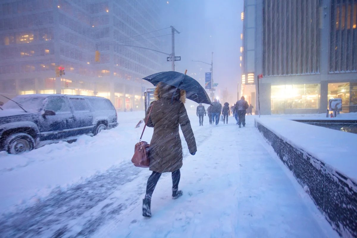
Manhattan during a snowstorm.
Bill Hornstein/Getty Images
A major winter storm is coming together over the U.S., with dozens of states and more than 160 million people likely to be affected by snow, ice and extreme cold from Friday to next Monday.
Forecasters so far have some idea of what will happen when the storm arrives: Some areas are in line to see a foot or more of snow, while others will experience freezing rain that will coat everything it touches in a dangerous cloak of solid ice. And different areas might get more modest snowfall or perhaps merely a cold and soggy day.
But predictions of which places will get hit with what weather has shifted from day to day and even hour to hour. What gives?
On supporting science journalism
If you’re enjoying this article, consider supporting our award-winning journalism by subscribing. By purchasing a subscription you are helping to ensure the future of impactful stories about the discoveries and ideas shaping our world today.
In short, weather forecasts are incredibly hard to get 100 percent right ahead of time, particularly for wintry weather. The reasons why are complex. But knowing what to look for in forecasts as they come out ahead of winter storms such as this weekend’s can help you better prepare.
What is causing this weekend’s winter storm?
Let’s start from the beginning: Why is so much of the U.S. in for such a powerful winter storm? Essentially, the cause is Arctic air surging southward over the contiguous U.S., just as a low-pressure area is moving eastward, pulling up moisture from the south. When moisture and cold temperatures meet, the result is some combination of snow, sleet and freezing rain.

Expected minimum wind chills across the U.S.
But that’s just the basics. Several features in the atmosphere are critical to understanding this particular storm. A key question for forecasters is whether a blob of Arctic air that is heading south encounters the eastward-moving low-pressure area, meeting in such a way that they “phase”—essentially combining into one larger, stronger storm. If that happens, it will strengthen an area of high pressure that is hanging out off the coast of the southeastern U.S., which will push warm air from the south farther north and shift snowfall northward, too.
Complicating matters further is an area of high pressure that is sitting above Alaska and influencing how everything downstream of it is moving.
Long story short, there are a lot of moving parts coming together to make this storm. And “the more complex the middle and upper level flow [in the atmosphere] is, the harder it is for the models to forecast it,” says Alan Gerard, a meteorologist and CEO of Balanced Weather.
What do weather models show?
If you have been paying attention to the forecasts ahead of the weekend, you might have noticed that different forecasts rely on different models, such as those respectively used by the U.S. National Weather Service and the European Center for Medium-Range Weather Forecasts. These models are tools employed to predict the weather based on various measurements of the atmosphere, temperature and other factors—and they can have vastly different outcomes. Broadly speaking, however, the European model outperforms the rest in terms of predictive accuracy.
Weather models are the product of human ingenuity and decades of scientific research, but they’re not perfect. They’re not meant to be. To make these models, scientists must approximate—essentially make a good guess of—a lot of the physics of the atmosphere. Different weather services make distinct choices about what their models will prioritize based on the kinds of weather they typically deal with—the U.S., for example, cares more about modeling for tornadoes, but the U.K. Met Office doesn’t really need to because they are just so much rarer in that nation.

Areas in red and orange have a higher chance of getting more than six inches of snow.
Data are also important for these models: the more detailed and accurate the data are, the better the forecasts will be. A key information source is the twice-daily balloon launches from most U.S. weather offices scattered around the country. These provide a timely “snapshot” of the atmosphere. But some weather offices in Alaska haven’t been able to have regular launches recently because of staffing shortages and equipment issues. That could be affecting the quality of the data going into models—data that are especially important for this storm because of that high pressure area over Alaska.
Still, having a range of models with their own strengths and weaknesses is useful because they give a fuller picture of plausible scenarios, Gerard says. “The sum of all the parts gives you the best answer,” he says.
Indeed, the various national models are converging as the storm approaches—in this case, they’re all starting to show what the European model has roughly predicted all along: that the phasing meteorologists are worried about will indeed occur.
No matter what, this storm is going to be messy
As the models start to fall in line with each other and meteorologists get a firmer sense of what the path and timing of the storm will be—and who will get snow or ice—there nonetheless will be little quirks of the storm that could scuttle even the best forecasts.
Heavy rains and snows often arrive in what are called “bands.” Exactly where those bands will form isn’t easy to predict even on the day of a storm. And where the bands form can be the difference between, say, 10 inches of snow in one spot and just a couple inches or even none a few miles away. And storms are, ultimately, highly dynamic environments. Tiny changes in temperature or air flow in the upper atmosphere can result in big consequences on the ground.

Areas in red and orange have a higher chance of a least a quarter of an inch of freezing rain.
So if you are among the tens of millions of people in the U.S. who are wondering what’s in store for them this weekend, here are a few general things to keep in mind. Now that we are less than a day or two out from the storm’s predicted start, forecasts are becoming more accurate, but don’t be surprised if things change between now and next Sunday. Instead keep an eye on them and prepare for the risks.
As Gerard points out, there is only so much that meteorologists can tell you ahead of time. “We’re predicting the future. Have any of you tried to predict the future lately?” Gerard says. “I find it amazing that we’re able to do as well as we can.”
It’s Time to Stand Up for Science
If you enjoyed this article, I’d like to ask for your support. Scientific American has served as an advocate for science and industry for 180 years, and right now may be the most critical moment in that two-century history.
I’ve been a Scientific American subscriber since I was 12 years old, and it helped shape the way I look at the world. SciAm always educates and delights me, and inspires a sense of awe for our vast, beautiful universe. I hope it does that for you, too.
If you subscribe to Scientific American, you help ensure that our coverage is centered on meaningful research and discovery; that we have the resources to report on the decisions that threaten labs across the U.S.; and that we support both budding and working scientists at a time when the value of science itself too often goes unrecognized.
In return, you get essential news, captivating podcasts, brilliant infographics, can’t-miss newsletters, must-watch videos, challenging games, and the science world’s best writing and reporting. You can even gift someone a subscription.
There has never been a more important time for us to stand up and show why science matters. I hope you’ll support us in that mission.